A giant leap in orbital imagery is what we need to realize advanced Moon missions
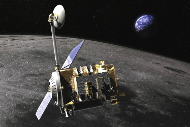
Illustration of the LRO spacecraft orbiting our Moon. Image: NASA / GSFC / Chris Meaney
At over 1.6 petabytes, NASA’s Lunar Reconnaissance Orbiter (LRO) mission hosts by far the largest dataset from any planetary science spacecraft ever launched. LRO’s high-resolution lunar imagery and topographic data has been the bedrock for selecting landing sites of most Moon missions launched this century from around the world. Many of these landers though were planned as short or mid duration missions at best, whereas the next generation of landers and rovers will explore unknown ground truths about water ice and other resources amid unfavorable lighting conditions at the Moon’s south pole. These will not only need more granular orbital imagery to plan precision landings but comprehensive environmental datasets that allow missions to last long enough.
But NASA’s 2009-launched LRO has gracefully aged now. It’s due for its final mission extension evaluation this year, and has limited capabilities left. LRO’s inertial measurement unit has degraded, and it can no longer maintain an orbit that can study the lunar poles from directly above them; its orbit is now inclined. Recognizing these constraints, a specialized team of US scientists released a report called CLOC-SAT in 2022 urging NASA to plan replacing the LRO with an enhanced approach so as to support the increasingly complex and diverse upcoming robotic CLPS and crewed Artemis Moon missions.
Three years since, NASA has not approved any LRO successor despite the LExSO mission being proposed by members from the LRO team itself. NASA’s FY2026 Presidential budget request does not ask for any funding for the same.
What will stand on the shoulders of the giant?
On the US’ side, there is NASA’s ShadowCam imager, which launched aboard South Korea’s KPLO lunar orbiter in 2022. It images polar craters that are permanently shadowed. However, it has found no reflectance differences that can be uniquely attributed to surface water ice in most of the areas it has mapped so far. To be clear, this isn’t a failure of ShadowCam, the instrument. But given that KPLO’s mission will likely end this year, the dull outcome highlights the pressing need for higher-resolution studies from orbit and the surface, neither of which are taking place substantially.
India’s Chandrayaan 2 orbiter, a full-fledged reconnaissance spacecraft like LRO, has fulfilled a few advanced needs. Having launched a decade later, it’s also more capable in certain areas, such as having a better radar as well as a better imaging resolution of up to 0.25 meters/pixel—twice LRO’s finest. Scientists who authored the aforementioned report for NASA recognized the Chandrayaan 2 orbiter’s capability in mission planning:
“Additional imaging of the lunar surface at sub-meter scales (e.g., 30 cm) is highly desirable to facilitate identification of roughly m-scale hazards that are often relevant to finding safe landing sites. As an example, the Chandrayaan-2 Orbiter High Resolution Camera (OHRC) has a nominal pixel scale of 30 cm from a 62 km altitude orbit.”

Images: NASA / GSFC / ASU / LROC / ISRO / C. Tungathurthi | Graphic: Jatan Mehta
Through its instruments, the ISRO orbiter has been producing a trickle of this next layer of lunar water results. The orbiter also helped JAXA’s SLIM spacecraft achieve the most precise Moon landing ever for a robotic vehicle, touching down only 55 meters from its targeted point. ISRO shared Chandrayaan 2 data with JAXA for final landing site selection as well as for SLIM’s onboard last-mile navigation maps. Without the world’s sharpest lunar imager, it wouldn’t be possible for SLIM to spot and navigate to a safe touchdown point without compromising on the landing accuracy—the primary mission goal. The two agencies are now collaborating on the joint LUPEX rover mission to study water ice on the Moon’s south pole.
Similarly, NASA has been collaborating with ISRO to have the Chandrayaan 2 orbiter aid Artemis landing site selections by prospecting for lunar polar water, classifying hazards, and gaining better topographic data about polar sites. But NASA’s leveraging and ISRO’s promoting of the orbiter’s optical and radar capabilities have been limited in scope. Moreover, the orbiter is likely to end its nominal operations by the end of the decade if not before that with no immediate replacement planned or announced by ISRO.
Commercial services coming up

Illustration of the Ocula lunar imaging service. Image: Firefly
Seeing the opportunity to fill gaps in the apt planning of future, more complex Moon missions, especially in the case of NASA, commercial companies are entering the landscape of orbital imagery and mapping.
US-based Firefly announced a commercial lunar imaging and mineral detection service called Ocula to hope to carry forward a part of LRO’s foundational role. The service will commence with the first Elytra Dark orbiter next year from low lunar orbit. The orbiter will do so after completing its services for Firefly’s upcoming second Moon lander mission part of NASA’s CLPS program. Firefly says Ocula’s best case optical imagery will tout a then-best resolution of 20 cm/pixel.
Blue Origin has announced that it will send an “ultra-low” polar orbiter called Oasis-1 to the Moon to “create the most detailed high-resolution maps to date of lunar water ice, Helium-3, radionuclides, rare earth elements, precious metals, and other materials”. The mission will be in partnership with the Luxembourg Space Agency, ESA’s space-resources-focused ESRIC institute, and GOMspace. The company has not yet specified when Oasis-1 will launch or what its altitude range will be to enable the required outcomes.
On the other side of the world, ispace has been selected as part of Japan’s 1-trillion yen “Space Strategy Fund” initiative to develop, launch, and operate a lunar orbiter which will use a terahertz wave sensor system to locate and map water ice deposits on the Moon’s poles. Data from this orbiter will be analyzed in tandem with direct surface and subsurface measurements made by the upcoming joint Indo-Japanese LUPEX rover mission.
Coordinate to catalyze
All of these commercially driven orbiters, while welcome, are specialized and have relatively limited use cases. The expansive scope of future missions leading up to Moonbases still requires having the whole spectrum of orbital datasets, especially for helping locate and explore swaths of water ice and permanently shadowed regions on lunar poles—something the US has been failing at despite it being central to Artemis.
To that end, scientists have formally recommended NASA through the aforementioned CLOC-SAT report as well as other means to coordinate future lunar orbital measurements and capabilities. This, the report has argued, necessitates having a slew of interconnected lunar orbiters—both long-lived ones like LRO & Chandrayaan 2 as well as specialized ones—instead of a single successor.
“Meeting these [future mission] goals will require multiple approaches involving several orbits and/or orbiters, but there are a large number of stakeholders in our return to the Moon, including commercial and international partners, whose resources can be shared and leveraged to meet diverse goals while minimizing cost.
[…]
NASA should establish a single office tasked with coordinating across space agencies and within NASA for sharing resources, such as communications networks and orbital strategies. For example, a spacecraft’s orbit altitude and orbit plane could be chosen partially based on the requirements of other orbiters.”
Open Lunar Foundation’s Lunar Ledger project aims to help catalyze acting on this advice by allowing more commercial and national mission operators to reliably share technical data at mutual discretion. Six companies have signed up for the Ledger at launch with an eye towards mission data sharing: ispace, Firefly, Astrolab, JAOPS, Dymon, and SpaceData. Similar to how NASA, ESA, and ISRO have been planning to perform coordinated imaging and scientific observations of Venus with their respective upcoming missions, lunar orbiters from across the world could coordinate and build atop their respective observations to accelerate progress and improve output for all while saving costs. Christine Tiballi, the Lunar Ledger’s Lead, is particularly excited about the possibilities of orbital data enabling better rover missions, which in turn enhance quality of orbital datasets that later missions can leverage:
“We've included market signals like data sharing and available payload space, so that any mission can communicate their interest as a provider or a consumer of these assets. So say an upcoming rover is to traverse projected operational coordinates of another future mission, capturing data at unprecedented resolutions. Tapping into it will not only improve calibration of public orbital datasets and significantly increase the chances of future mission successes but also signal operational orbiters to enable planning for that rover traverse in the first place.”
This way you have the opportunity to be the supplier and enabler as well as the customer while reducing building costs. “Suddenly competition can become very lucrative cooperation,” adds Tiballi.